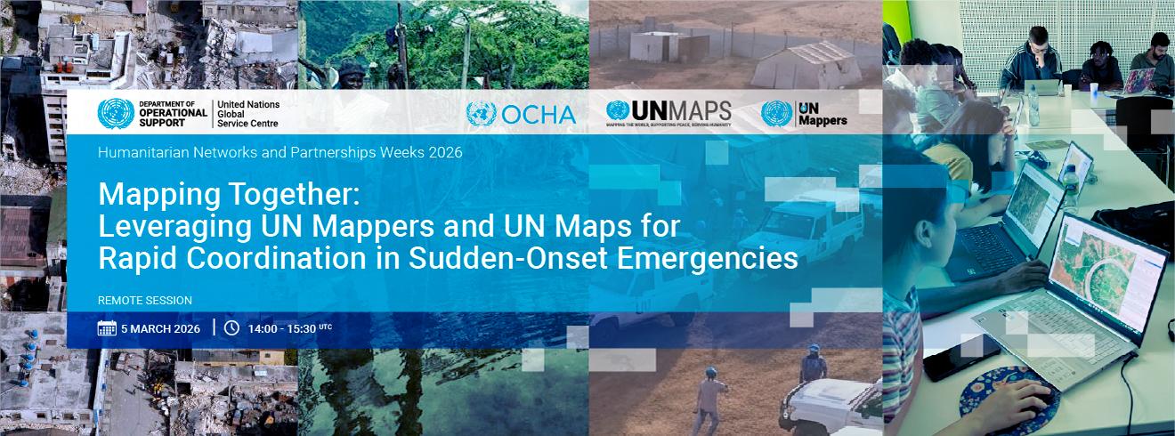
The United Nations Global Service Centre will take part in the 2026 edition of Humanitarian Networks and Partnerships Week (#HNPW), organized by United Nations Office for the Coordination of Humanitarian Affairs (#OCHA) — one of the largest global gatherings focused on solving operational challenges in humanitarian action.
On 5 March | 14:00–15:30 UTC, the UN Maps (on behalf of #UNGSC) team will host a remote session:
“Mapping Together: Leveraging UN Mappers and UN Maps for Rapid Coordination in Sudden-Onset Emergencies.”
When crises strike, timely geospatial data is critical. It helps responders assess impact, prioritize needs, and allocate resources effectively. This session will examine how UN Maps and the UN Mappers community strengthen coordination and decision-making during sudden-onset emergencies.
If you work in humanitarian response, geospatial analysis, information management, crisis coordination, or just curious — this conversation is for you.
Join the session and be part of the discussion: http://www.hnpw.org/