The UNGSC Service for Geospatial, Information, and Telecommunications Technologies (SGITT) provides a direct single point of contact for digital technology services and solutions.
SGITT works with field missions and the United Nations Office of Information and Communications Technology to ensure round-the-clock, resilient information and communications technology, and geospatial information services (GIS).
Based in Brindisi, Italy, and in Valencia, Spain, SGITT is the operational hub for a wide range of clients, including Peacekeeping operations, Special Political Missions, United Nations Agencies, Funds, and Programmes.
SGITT is also instrumental to the implementation of key organizational strategies, such as the Secretary-General’s Data Strategy, the Secretary-General’s Strategy on New Technologies and the Strategy for the Digital Transformation of UN Peacekeeping
Our Flagship Initiatives
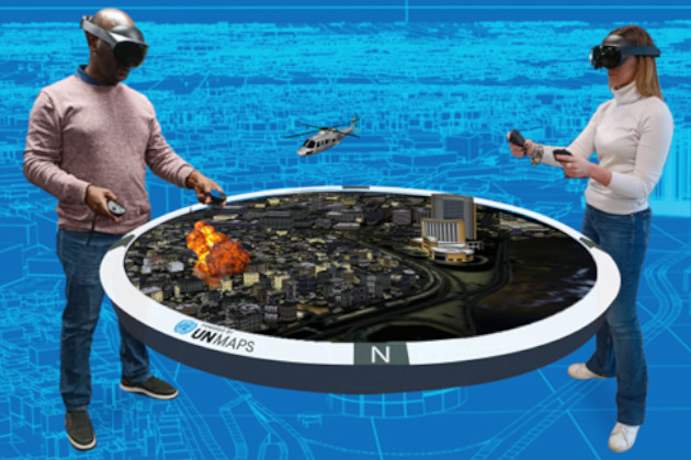
Extended Reality and Virtual Training Capacity
Technology-enabled immersive and collaborative experiences to enhance situational awareness in high-risk environments.
Extended Reality and Operational Virtual Training Capacity are proving to be critically useful for logistics and security preparedness in remote, high-risk areas. By providing immersive and collaborative experiences, users simulate the reality on the ground and gain insights for strategic planning, site selection, training, and security operations, among other use cases. The enhanced situational awareness enabled by this technology is vital for peace operations and UN activities in challenging environments. Driven by the United Nations ICT Strategy and Roadmap, and the UN Secretary-General’s Strategy on New Technologies, this initiative is paving the way for next-generation visualizations.
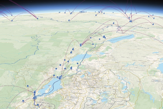
UN Maps
Location-based information technology services that utilize crowd-sourced and UN authoritative data for improved planning, management, and decision-making.
United Nations Maps or UN Maps is a groundbreaking initiative that provides the most accurate, up-to-date and reliable location-based information for the UN’s operational activities, including in remote areas. By enriching topographic and operational data over the UN’s areas of interest, UN Maps provides deep insights into patterns, relationships, and situations that can help peacekeeping and humanitarian actors make smarter decisions. UN Maps’ innovative utilization of crowd-based, as well as UN authoritative data; automated data pipelines; online analytics tools; and self-service geospatial applications, is helping to transform the United Nations into a data and analytics-driven Organization, in line with the Secretary General's Data Strategy and in support of the implementation of the Sustainable Development Goals. Currently utilized by UN Peace Operations, Agencies, Funds, and Programmes, UN Maps aspires to broaden its reach, opening its data and services to support state-building, planning, and resource management activities in host countries and local communities.

3D PAAS
Zero-waste 3D printing, design and modeling for fast, efficient, and sustainable spare part production.
3D Printing as a Service or 3DPaaS is transforming the traditional manufacturing process of spare parts for Field Missions and other UNGSC clients, by reducing time and cost, and eliminating the carbon footprint. The service’s environmentally friendly 3D printing, design, and modeling solutions utilize a Complete Plastic Recycling System, which ensures that waste generated during the printing process is minimized and put to good use, with all discarded plastic materials collected and shredded to create new filament. The user-friendly service also provides an online repository divided into commodity categories, enabling users to easily search for, locate, and select parts they require.
Unite FRIM
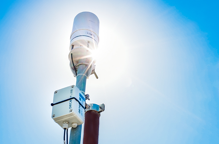
Robust, scalable Internet of Things ecosystem for environmental sustainability, responsible consumption, and data-driven resource management.
Unite Field Remote Infrastructure Monitoring or Unite FRIM is a system that provides real-time data collection and analysis by monitoring and connecting smart infrastructure and equipment, such as water meters, energy meters, and fuel meters. A central, standard management system that transforms input data to a range of outputs that meet different end-user needs, Unite FRIM offers vital insights to decision-makers. Inspired by the concept that you cannot improve what you cannot measure, Unite FRIM helps support compliance with environmental and resource consumption goals, in line with the UN Department of Operational Support’s Environment Strategy that calls on field missions “to achieve maximum efficiency in their use of natural resources and operate at minimum risk to people, societies, and ecosystems.”
M-Products
Operational ICT readiness for the rapid deployment of UN operations worldwide.
Modular Products or M-Products are rapidly deployable, energy self-sufficient, easily transportable, customized containers that house all necessary ICT equipment for UN activities in areas lacking infrastructure. These containers are both rugged and sophisticated. Designed to sustain harsh conditions, M-Products also embrace the most recent Internet of Things (IoT) technologies, enabling interconnectivity, monitoring, support, and data-driven energy management, through the Unite Field Remote Infrastructure Monitoring (Unite FRIM) platform. With over 150 units already deployed, M-Products are key technological enablers in often hostile areas where agility and responsiveness are essential. They are part of the “M-Programme,” a joint flagship programme of the UN Department of Operational Support (DOS) and the UN Office of Information and Communications Technology (OICT), developed through the collaboration between UNGSC and UN peacekeeping and special political missions.
Our Services
To optimally support the digital transformation of the United Nations, SGITT has
organized its services into three functional pillars, namely Core, Specialized, and
Transformative Digital Technology Services.
Core
Digital Technology Services
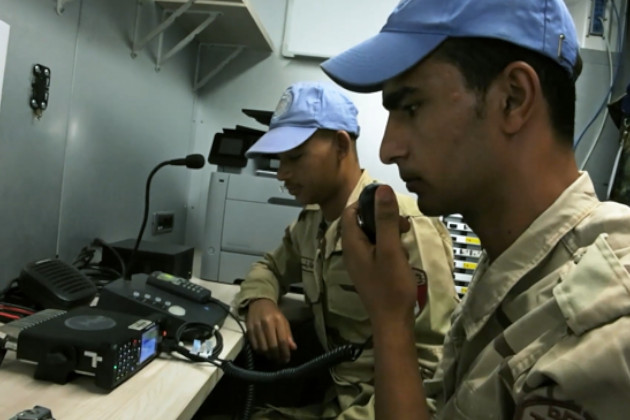
Connectivity
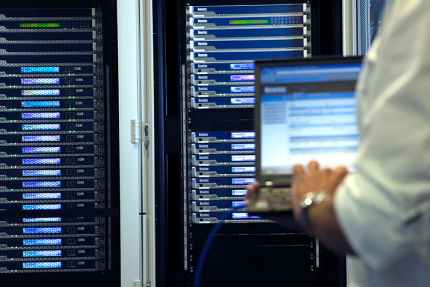
This category encompasses a comprehensive suite of services that facilitate connections between devices and users to the United Nations enterprise network and the Internet. It includes network connectivity, voice communication systems, leased line connections, satellite connectivity, and digital radio services. These offerings are designed to enable both primary sites and remote locations to access a reliable, high-availability network for enterprise applications and internet connectivity. The backbone of the digital technology ecosystem at UNGSC, connectivity services ensure seamless communication and data transfer across the Organization.
Hosting
The essential infrastructure to run and maintain critical IT workloads and applications efficiently, this category includes the provision of virtual server environments that offer flexibility and scalability; robust storage solutions designed to accommodate growing data needs; and highly reliable rack space, ensuring stable operations. Complementary offerings such as data backup, replication, and web hosting further enhance the overall service suite. Together, these components create a comprehensive hosting environment enabling organizations to ensure high availability and performance for their key workloads.
Monitoring
Comprehensive, 24/7 monitoring and management of critical infrastructure, conducted by the Network Control Center (NCC) at UNGSC, ensuring constant vigilance over core IT infrastructure and customer devices. This category also includes specialized services such as Field Remote Infrastructure Monitoring (FRIM), which provides oversight to crucial field infrastructure assets such as fuel tanks, water deposits, and energy devices. These monitoring solutions employ advanced technologies to identify alerts and facilitate rapid response to potential issues.
Solutions Support
This category is dedicated to the provision of IT-enabled solutions for UNGSC clients, including a wide range of geospatial systems, such as Unite Geoportal, Unite Maps, GeoVisualization, GeoImagery, and GeoData. Additionally, it includes other offerings such as the Standard Software Distribution Service (SSDS) and the Read-Only Migrated Application (ROMA), facilitating the secure storage of information from decommissioned applications in a highly available environment.

Specialized
Digital Technology Services
Geo-Analytics Services
Enabling the assessment of environmental and security risks, as well as war damage; identification of safe locations for camps; detection of near surface utilities; and identification of drilling targets for water wells, to name a few examples. Services include optical and radar satellite image enhancement and processing; 3D analysis and modelling; geospatial intelligence; hydrological modelling; sub-surface and groundwater exploration, as well as flood risk assessment and remote environmental assessment and support.
System Integration Services
The integration of multiple digital technology components into deployable systems or into other functional elements such as shelters, or vehicles. M-(Modular) products — customized, sustainable, energy self-sufficient shipping containers that house all necessary ICT equipment for field personnel in remote locations — are a key example.
Disaster Recovery Exercise
Assistance in testing resilience, in the case of disaster affecting a client’s primary systems or applications and failing over to any secondary site. This exercise ensures that the Recovery Point Objective (RPO) and Recovery Time Objective (RTO) expected from system and application owners are viable.
Digital Technology Consultancy Services
The provision of support or advisory services in the areas of Information Technology (IT), Operational technology (OT) and Communication Technology (CT) to allow the continuous digitization and transformation of business processes.
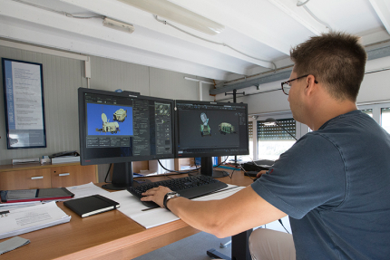
Digital Twins Production Services
A digital representation of reality. Utilizing imagery captured through satellites and drones, 3D models of UN camps or large areas are created, providing users with a visualization of the situation on the ground, with numerous applications including infrastructure assessment; planning; inspections; and training.
3D Printing as a Service (3DPaaS)
3DPaaS is the operation of a 3D models management platform to support the production of critical spare parts and other necessary items in a short period of time using recycled material when possible. Benefits include the reduction of emissions, time and labor. The service may be expanded to include crane technology for the building of homes with readily available materials.
Live Video Analytics
This comprehensive solution integrates advanced artificial intelligence (AI) tools with sophisticated analysis and visualization capabilities. Designed for cloud deployment, it offers robust monitoring and alert functionalities for critical applications such as crowd management, restricted area access control, vehicle and pedestrian tracking, and automated vehicle identification.
Transformative
Digital Technology Services
Extended Reality (ER) Technologies
ER at UNGSC ranges from the provision of remote support using Augmented Reality tools and technologies, to advanced Virtual Reality applications. A key example is the Virtual Operations Centre (VOC), a platform that employs ER and geographical information system (GIS) to provide an immersive, tactical sandbox experience, for the preparation and training of personnel deploying to high-risk areas; planning; and decision-making.
Uncrewed System Services (USS)
Consulting, design, implementation, and training for the proper operation of USS by military, law enforcement, and civilian actors, with diverse applications including the detection of mines, insurgents, or illicit weapons cargo; search and rescue; the delivery of key medical supplies to areas that would otherwise be inaccessible. Cover Class I Uncrewed arial systems, counter-UAS capabilities, uncrewed underwater systems, and uncrewed systems digital forensics.
Tracking as a Service (TaaS)
Tracking as a Service (TaaS) provides near real-time visibility and comprehensive monitoring of mobile assets. By integrating advanced hardware and software solutions, the service enhances asset traceability, safety, and operational efficiency, mitigating risks associated with traditional manual tracking methods.
![]()
Business Service Catalogue
[DISCLAIMER] This content has still to be defined. This text is just a placeholder for testing purposes. [DISCLAIMER]
SGITT Catalogue
SGITT of the UNGSC supports Peacekeeping operations, Special Political Missions, as well as UN Agencies, Funds and Programmes with round-the-clock, high-availability and resilient information and communications technology, and geospatial information services. SGITT is the operational hub for the support and delivery of ICT services and solutions to field operations