Specialized
A range of innovative services designed to enhance and complement core technology offerings, this category includes advanced capabilities such as 3D printing, IT consultancy, digital twins, and geospatial services, providing organizations with tailored expertise to address unique technical challenges and unlock new opportunities.
GeoAnalytics and Intelligence
- A comprehensive suite of services, including monitoring and assessment, suitability analysis, image classification and modeling, threat simulation, and 3D feature extraction, as well as customized analysis, produced according to recognized standards and based on GeoData, GeoImagery, and user-provided datasets
- Provision of analysis results in digital format or accessible via interactive web maps through the Unite GeoPortal Catalogue
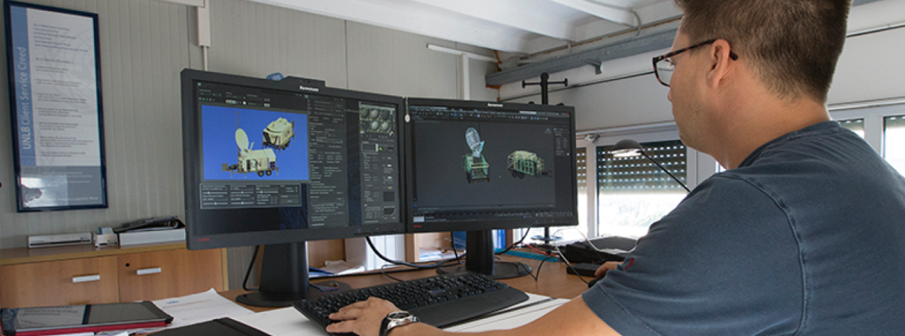
3D Printing as a Service
- Environmentally-friendly production of critical spare parts and essential items with an advanced 3D printing platform, utilizing recycled materials whenever possible
- Reduced emissions, production time, and labor costs, while enhancing operational efficiency
- Features include access to an online repository to quickly search, locate, and select the required spare parts, for minimal downtime and faster turnaround
Disaster Recovery Exercises
- Assistance in testing resilience, in the case of disaster affecting a client's primary systems or applications and failover to a secondary site
- Assessment of the Recovery Point Objective (RPO) and Recovery Time Objective (RTO) to ensure defined times for recovery
- Comprehensive support from initial planning and preparation to execution and post-exercise evaluation
Geospatial Remote Mission Support
- Remote geospatial support for UN missions
- Mapping and cartographic services
- Geospatial analysis and intelligence
- Imagery acquisition and exploitation
- Geospatial data management
- Development of tailored geospatial solutions
- Operational support from Brindisi and Valencia
- Reduces in-mission GIS staffing requirements
- Delivers consistent, high-quality geospatial services
GeoTraining
- Training on key geospatial topics, including map reading, field data verification, GPS data collection, and more
- Flexible options ranging from off-the-shelf courses to customized trainings to meet clients' specific needs
- Convenient locations for training including on-site, at the Regional Service Centre Entebbe (RSCE), or at the United Nations Global Service Centre (UNGSC)
Groundwater Exploration and Monitoring
- Specialized studies to design targeted drilling campaigns, optimizing the chances of discovering groundwater in arid and semi-arid regions
- Utilization of remote sensing technology and geophysical survey methods to identify potential drilling sites for sustainable, productive groundwater wells
- Provision of monitoring services to ensure effective groundwater management
Sub-Surface Exploration
- Performance of studies optimizing the accuracy and success of underground target discovery, utilizing UNGSC’s proven methodology that combines satellite imagery and geospatial technology, with geophysical survey methods such as Ground Penetrating Radar (GPR)
- Applications include locating sub-surface utilities (e.g., pipes, cables), detecting pollutants, and identifying potential mass-grave sites
M-Products
- Rapidly deployable, customizable, and energy-self-sufficient shipping containers equipped with all necessary ICT infrastructure to support field personnel in remote locations or harsh conditions
- Features include integration with Internet of Things (IoT) technologies, enabling interconnectivity, monitoring, support, and data-driven energy management, through the Field Remote Infrastructure Monitoring (Unite FRIM) platform
Technology Assistance Service
- Provision of technology-related services, enabling clients to focus on their core business objectives
- Services range from strategic consulting to product and service deployments, data analytics, technology migrations, and specialized professional services
Technology Operations Service
- Management and maintenance of IT infrastructure, systems, and applications to ensure optimal availability, reliability, and performance
- Services cover a wide range of areas including system monitoring, troubleshooting, incident management, configuration and change management, capacity planning, security management and operational assessments
Digital Twin
- A digital representation of the real world, providing users with a visualization of the situation on the ground
- Utilization of imagery from satellites and drones to create accurate 3D models for UN camps or large areas
- Key applications include infrastructure assessment, strategic planning, inspections, and training
Live Video Analytics
- A comprehensive solution integrating advanced artificial intelligence (AI) tools with sophisticated analysis and visualization capabilities
- Designed for cloud deployment, providing reliable monitoring and real-time alerts
- Versatile applications for critical use cases such as crowd management, restricted area access control, vehicle and pedestrian tracking, and automated vehicle identification